Introduction
Ridge Clean Energy are developing a renewable energy park, consisting of a solar farm and battery energy storage system, on land between Thornholme and Haisthorpe in the East Riding of Yorkshire.
The application has now been submitted to the East Riding of Yorkshire Council and is available to view here by searching for Application Reference 22/02777/STPLF. You can also view the planning documents on ‘Documents’ tab of the website. The application has not yet been determined, and this website will be kept up to date posting news on:
- The Project
- Project Timeline
- Consultation
- Community Partnership
You can contact the project team using the link above with comments, questions, or ideas.
View Site Boundary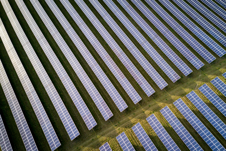

Project Outline
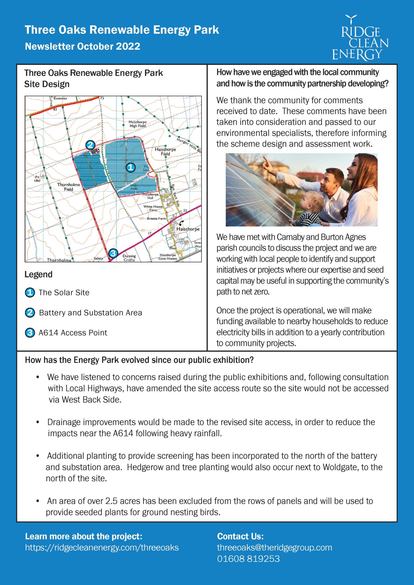
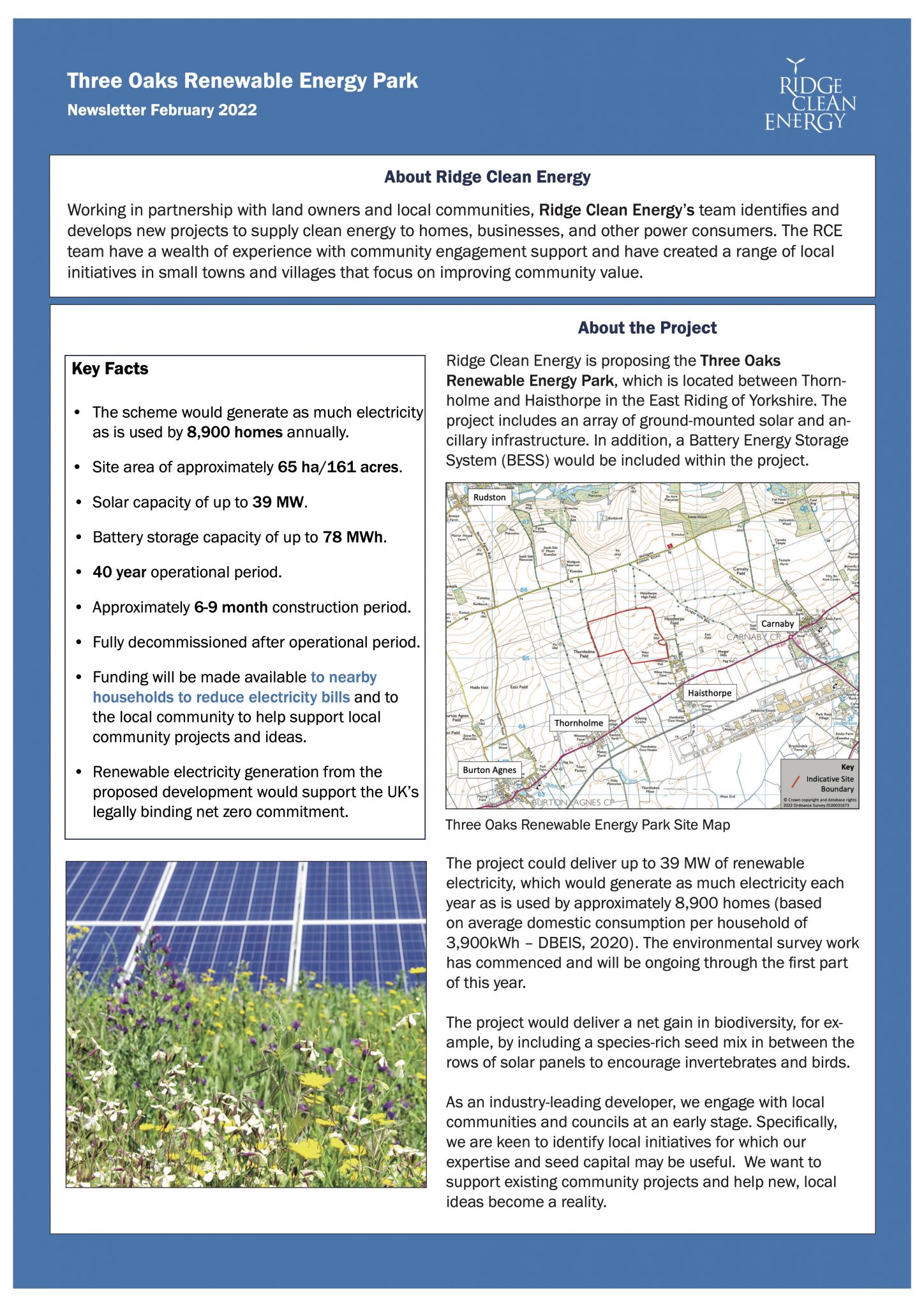
The project will be located on privately owned arable farm land 1km north-east of the village of Thornholme.
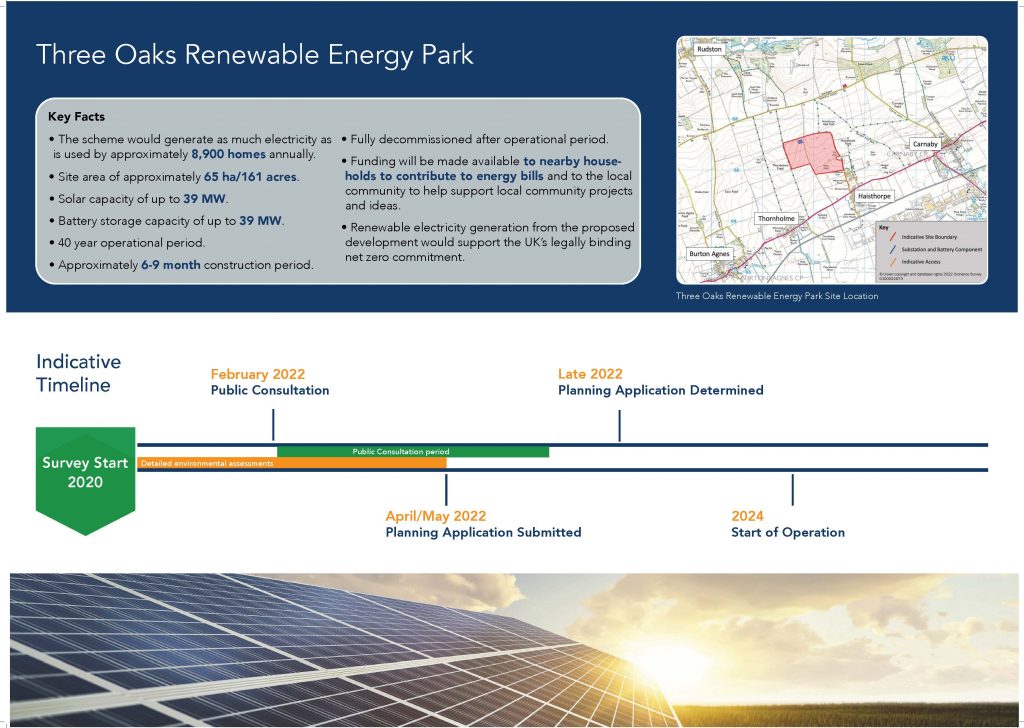
- The project could generate up to 39MW solar photovoltaic electricity.
- The project could host up to 78MWh of BESS (Battery Energy Storage System).
- It is currently estimated that the solar farm will generate the equivalent electricity needs of approximately 8,620 East Riding of Yorkshire homes (based on average domestic consumption per household of 4020kWh p.a., DBEIS 2021).
- From the displacement of electricity generated from fossil fuel powered generation, the proposed development would offset the emissions of a significant quantity of carbon dioxide. This reduction in emissions would contribute to the national legislation of net zero emissions by 2050.
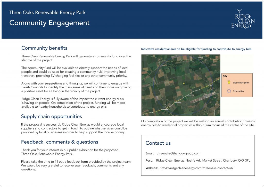
- Once the renewable energy park is operating, funding will be made available to the local community to help fund community initiatives.
For more information on our community ethos and the community benefit fund for Three Oaks please click on the links above.
Infrastructure, Surveys & EIA Screening
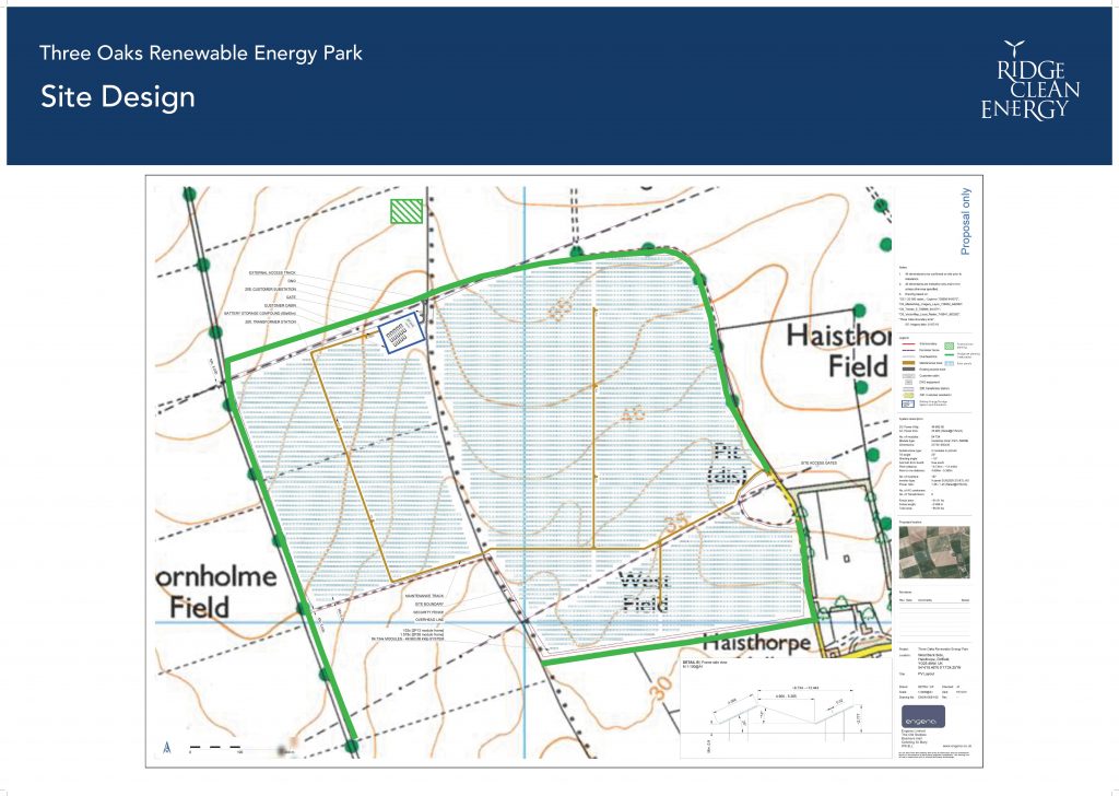
Infrastructure
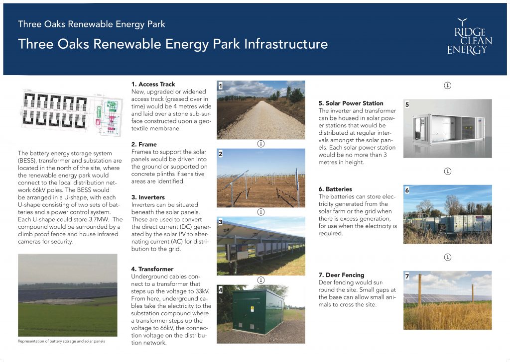
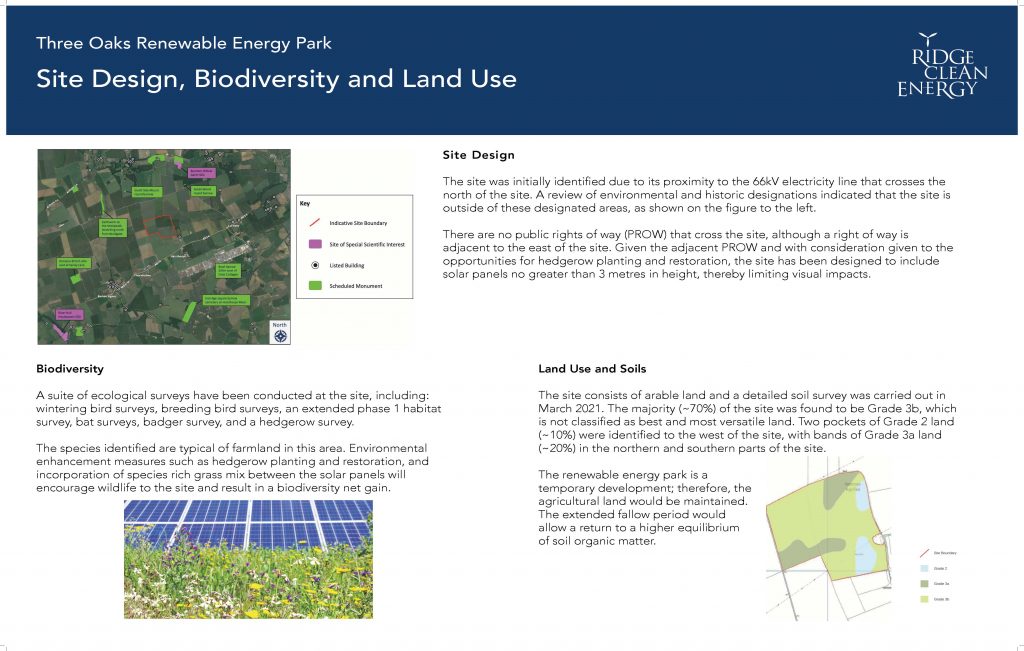
A range of infrastructure will be required as part of the new renewable energy park, which will include ground-mounted solar panels, inverters, a Battery Energy Storage System (BESS), transformer units, switch gear and substation, and temporary construction compounds.
Surveys
Our proposals and designs for the site have been guided by data gathered during surveys, technical assessments, and by advice provided by independent environmental consultants. Surveys began in winter 2020 and continued into 2022. The technical assessment reports are provided with the Environmental Report that accompanies the planning application.
EIA Screening Request
On October 6th 2021, Ridge Clean Energy submitted an EIA (Environmental Impact Assessment) Screening Request to East Riding of Yorkshire Council. In response to this request, the council have provided a Screening Opinion that an EIA is not required.
Solar Generation
39MW
Battery Storage
39MW

Homes Powered
Equivalent amount of power as is used by 8,620 homes
Project Timeline
|
October 2021 - EIA Screening Request In October 2021, we submitted an EIA Screening Request to East Riding of Yorkshire Council. |
|
|
EIA Screening Opinion Received - November 2021 In November 2021, we received the Screening Opinion informing us that an EIA is not required. |
|
|
Two Public Exhibitions Held - February 2022 On the 15th and 16th of February 2022, we held two public exhibitions, one in Carnaby and one in Burton Agnes. |
|
|
Planning Application Submission - October 2022 In October 2022, we submitted our planning application to East Riding of Yorkshire Council. |
|
|
Planning Determination - Spring 2024 In Spring 2024, we should receive the outcome of our planning application from East Riding of Yorkshire Council. |
|